In November 2014, the Jane Goodall Institute participated at the IUCN World Parks Congress in Australia with the support of JGI Global and especially Polly Cevallos, a member of JGI’s global board. Congress materials have just been made available online and JGI’s presentations are outlined below. Described as the “landmark forum on protected areas,” experts gathered to share information at the Congress, and work together towards the creation of an agenda for protected areas conservation. Specifically addressing the gap between conservation and sustainable development, the Congress adopted a theme of “Parks, people and planet: inspiring solutions.”
The Congress was highlighted with an inspiring video from Dr. Goodall who served as a patron to the event. Watch Dr. Goodall’s remarks above.
During the Congress, Lilian Pintea, JGI’s vice-president of conservation science presented two e-posters on projects that JGI is leading to help protected areas in the Congo Basin using geospatial imagery and mobile technology. The first, titled “People, Parks and Clouds: How Innovative Mobile and Web-Mapping Technologies Are Empowering Local Communities and Transforming Chimpanzee Conservation in Africa” covers how JGI has been working with local communities and rangers working in protected areas across the four countries where we work — Democratic Republic of Congo, Republic of Congo, Tanzania and Uganda — to jointly monitor forest habitats, wildlife and threats with mobile phones and tablets.
During the Congress, Lilian Pintea, JGI’s vice-president of conservation science presented two e-posters on projects that JGI is leading to help protected areas in the Congo Basin using geospatial imagery and mobile technology. The first, titled “People, Parks and Clouds: How Innovative Mobile and Web-Mapping Technologies Are Empowering Local Communities and Transforming Chimpanzee Conservation in Africa” covers how JGI has been working with local communities and rangers working in protected areas across the four countries where we work — Democratic Republic of Congo, Republic of Congo, Tanzania and Uganda — to jointly monitor forest habitats, wildlife and threats with mobile phones and tablets.
The second e-Poster titled, “The First High Resolution Maps of Chimpanzee Habitat Health in Africa,” covers JGI’s work funded by NASA in collaboration with the University of Maryland and other partners to develop a Decision Support System (DSS) to annually monitor chimpanzee habitat status and trends in Africa to support conservation action planning using Open Standards. The DSS integrates Landsat satellite imagery at 30 meter resolution, with chimpanzee suitability and forecasting models enhanced by the field data collected by the local communities and rangers using mobile phones and tablets.
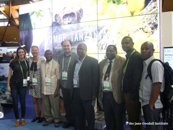
Using Google’s “hyperwall” on the floor of the Congress exhibit hall, Dr. Pintea made a demo of the Gombe Street View project, a collaboration between JGI, Google Earth Outreach and Tanzania National Parks (TANAPA). During the demo TANAPA delegation was in the audience and TANAPA’s Director General Alan Kijazi remarked how JGI and Google’s efforts to bring people to Gombe through Street View has generated huge online interest in the park. Below are Dr. Pintea with Director General Alan Kijazi and his team, and Google Earth Outreach at the hyperwall.